At some point in during the early grades, many students are introduced to concepts about neighborhoods and communities through a series of lessons that are taught within a larger instructional unit.
In this post, I’ll walk through the Community demo to show how NUITEQ’s Snowflake MultiTeach software can be used to enhance and extend the learning of concepts related to this topic.
The Community demo is anchored by the Nodes app, which supports multi-media concept mapping. This demo project is designed to work with the Media, Browser, and Lessons apps on a large interactive display or table using the Zones feature in MultiTeach, dividing the screen into two, three, or four sections. Nodes and Media folders, can be copied for sharing among teachers, and also used as starters for student projects and presentations. The demos serve as templates that can be easily modified to meet the needs of students in a range of grade levels.
During planning sessions, teachers can use the Nodes demo project to share standards-aligned resources and links related to the Community theme and outline details such regarding instructional strategies, technology integration, and methods of monitoring and assessing student progress. Google products such as Docs, Sheets, and Classroom can be accessed through the Browser app, as well as Google Drive. Teachers can upload sample lesson plans, rubrics prior to planning meetings and then access them during the meetings.
Teachers can review previously created lessons found on the MultiTeach Lessons Community related to the Community theme, or create new ones of their own using the MultiTeach Lessons app or Lessons Online.
Types of communities
The Community demo provides a variety of topics for use during instruction. In the following example, screen-shot, a parent node representing types of communities is opened to reveal a link to a video about city, suburb, and rural communities. When the link is selected, the video opens up for easy viewing.
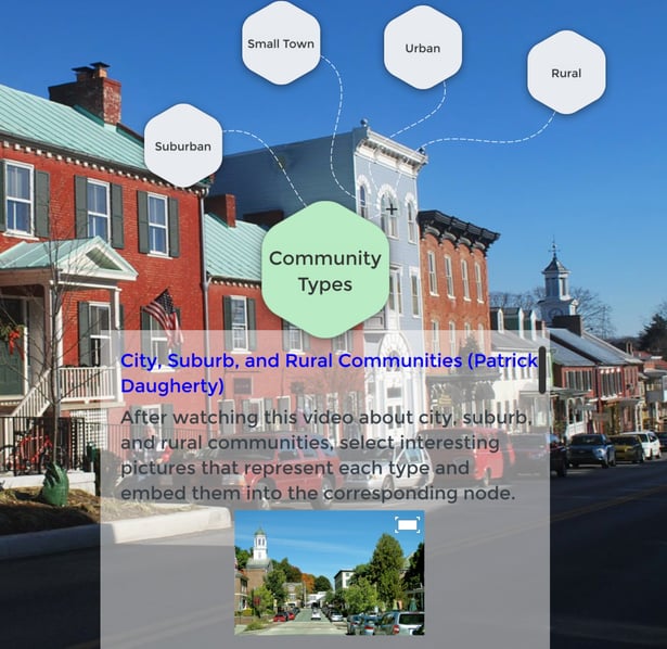
In this example, students follow the instructions and find pictures that represent each type of community and then embed them in the corresponding nodes. They can also enter text, links, and additional digital content.
Google Street View can be accessed through the MultiTeach Browse and provides a good way for students to remotely view neighborhoods, communities, towns, cities, and regions. Using the Zones feature, the screen can be divided into sections, with one or more locations accessed through the MultiTeach Browser app. This provides students with a way to compare and contrast the similarities and differences between each type simultaneously.
Neighborhood/Community walks
The Neighborhood Walk node in the example below contains a link to a lesson plan that includes documents that teachers can provide to their students for recording their observations during a class walk around the neighborhood of their school or around their homes. Teachers can repurpose this node for student use.
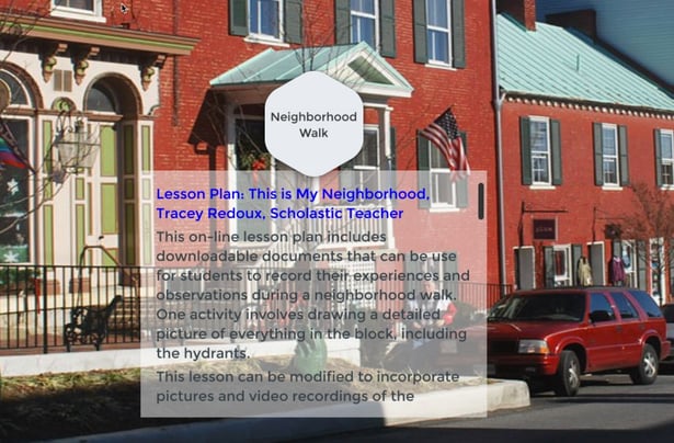
There are many activities that can precede neighborhood walks. Students can use Google Street View to take virtual walks around various neighborhoods. Since more than one Browser can be used at the same time using the Zones feature, students can compare and contrast views simultaneously. Students can view neighborhoods from a birds-eye view in Google Maps and use this information to plan their own maps of the neighborhood.
During the walk, students can stop to draw pictures of what they see. With the appropriate tools, students can digitally capture the details of the neighborhood from a multi-sensory approach. When they step outside, what details do they see? What are the sounds that they hear? This activity can include more than one walk. As a homework assignment, students can take a walk with a parent or other family member, and take pictures and note their observations. Notes can be written or recorded orally.
After the neighborhood walks have been completed, students can work in pairs or small groups to make their own maps, build a replica of part of the neighborhood, and create presentation using MultiTeach apps. Rubrics for these activities can be embedded in a node or in the Media app, or accessed online through the Browser app.
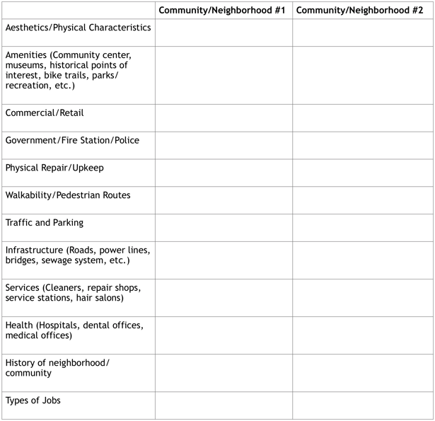
Older students can use the following chart to outline their observations and make comparisons of two different communities or neighborhoods. The form is designed for jotting written notes, but can also serve as the basis for creating a multi-media presentation of the observations. Information documented on this chart can also be used to create a Venn diagram of the similarities and differences between the two locations.
Learning in the community
In the example below, students discuss ways that people learn in their communities, and work in groups to complete a multimedia concept map. Each node can include additional nodes. These places are often favorite destinations for school-sponsored field trips, so during field trips, students can capture images and video clips. If field trips are limited, the projects can be completed through virtual field trips or web quests.
Students can add the content gathered during field trips, along with links and text, to flesh out the template. Content can also be added using the Media app. Students can use these apps during project presentations.
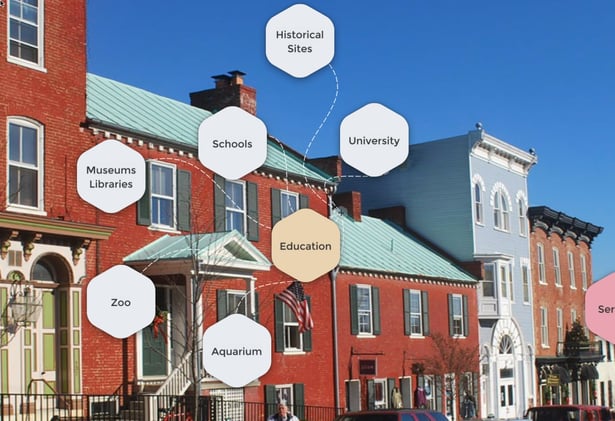
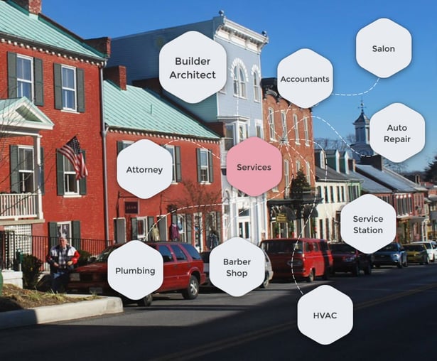
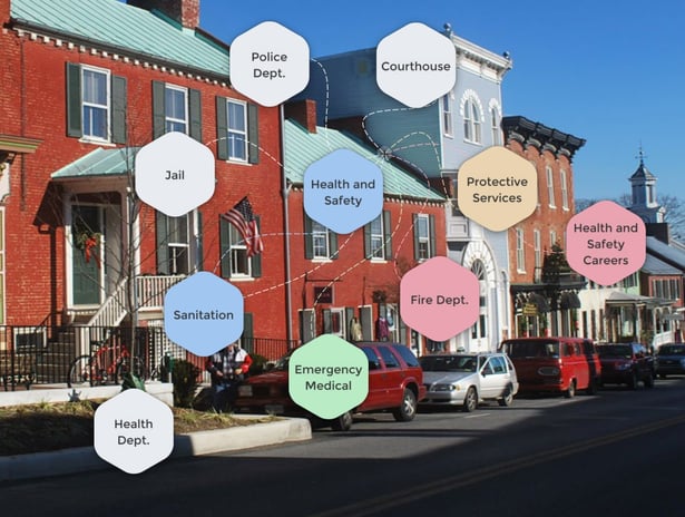
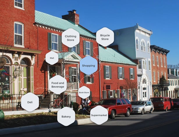
In the next set of screenshots, various topics related to the study of communities are organized into concept maps. The class can be divided into small groups, with each group assigned a different topic. Students share what they’ve learned with their classmates through multi-media presentations created with the MultiTeach Nodes app, supplemented by other apps such as Media or Lessons.
Services in the community
Health and safety in the community
Retail/Shopping
Jobs and careers
During the Community instructional unit, students learn about community places and also learn about the types of jobs and careers that are found within the region. Students learn more about adult roles in the community through interviews, across many different careers and locations. Teachers and students can arrange to interview people about their jobs remotely, through video conferencing.
MultiTeach software is ideal for creating learning stations. In the screenshot below, two lessons related to careers are on the left. The Community concept map is shown in the upper right, and the Media app is used for students to explore pictures related to various jobs.
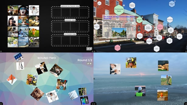
STEM integration
Students can learn more about their communities when STEM (Science, Technology, Engineering, Math) topics are integrated into learning experiences. Information about lesson plans for the following activities are linked in the resources section at the end of this post.
- Plan a City
- Plan a Park
- Plan a Playground
The following screenshot is part of the Community concept map about the renovation of a park and playground. Students look at pictures of items that were installed around the park during renovation and then determine the function of the items. This project requires the students to research the types of jobs that were required to plan the park’s renovation, and identify ways people from different fields worked together safely to complete the project.
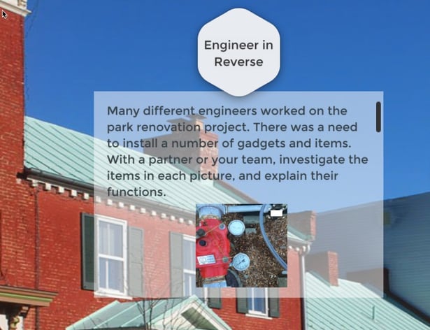
The Community demo was designed to support and enhance learning experiences on and off of the display and serves as springboard for teachers to use when developing unit and lesson plans on this topic. If you are interested in creating effective and engaging learning experiences for your students, take time to explore the resources listed below!
If you are an educator interested in getting a free 14-day trial of the Snowflake MultiTeach software, click the link below:
Resources
What is a Community: Grade 1 Unit Plan
Eastern Upper Peninsula Intermediate School District
Map Skills Thematic Unit Plan for First Grade
Janelle Cox, ThoughtCo. 8/8/17
Ten Ways to Use Google Maps in the Classroom
Jeff Utecht, The Thinking Stick, 3/5/15
Engaging Students Through Google Maps
Neil Jarrett, Edutopia, 7/7/16
WikiHow
Social Studies Lesson Plan: Community Helpers, Grades K-1
Pete Sullivan, Planetizen, 2/9/16
Florida CPALMS Lesson Plan, Engineering Design
Create A City: An Urban Planning Exercise, Grades 4-8
Arizona Geographic Alliance
Place-Based Learning: Connecting Kids to Their Community
Hood River Middle School, Edutopia, 4/19/16
NUITEQ

 3-in-1 Mic


